TSUSY - Tsunami Early Warning and Forecasting System
🌊📲🧠 #tsunami #early-warning #earthquake-monitoring #operational-system #random-forest #machine-learning
Description
IH-Tsusy is a real-time operational tsunami system that receives earthquake data from the USGS. Upon receiving seismic event data, the system evaluates whether the earthquake meets specific criteria indicative of potential tsunami generation. If so, it automatically launches:
Numerical simulations of tsunami propagation.
Notifications through a mobile app.
Interactive maps showing wave heights and travel times from the epicenter to the impacted coasts.
 {fig-align=”center” width=”150”}
Overview
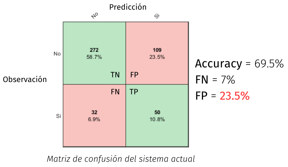
The goal of the current work is to improve IH-Tsusy’s decision support system by replacing the traditional binary criteria — based on focal depth and slip — which rely heavily on expert judgment.
A machine learning approach is proposed to enhance decision accuracy using a Random Forest Classifier trained on historical seismic and tsunami data.
 {fig-align=”center” width=”60%”}
🖥️ 🎞️ Full presentation (Nov 28th, 2023): View on Canva
Modelling
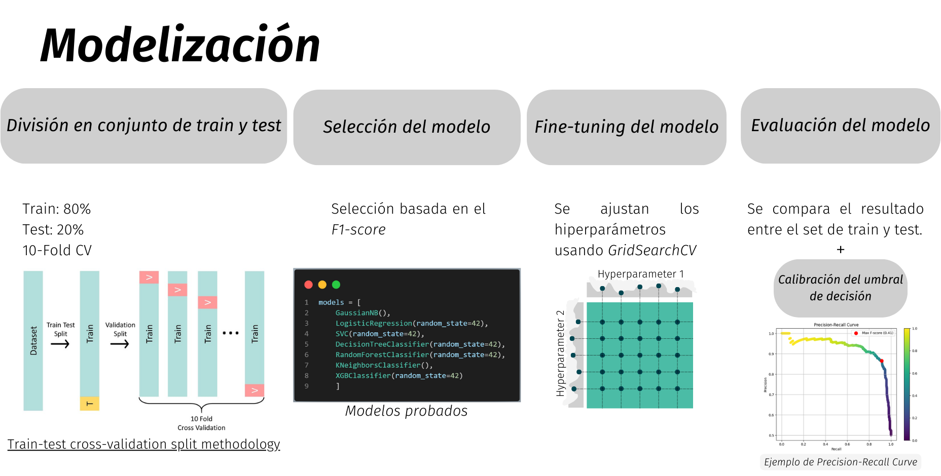
The following figure illustrates the workflow and modelling methodology for tsunami event classification and simulation.
 {fig-align=”center” width=”80%”}
Results
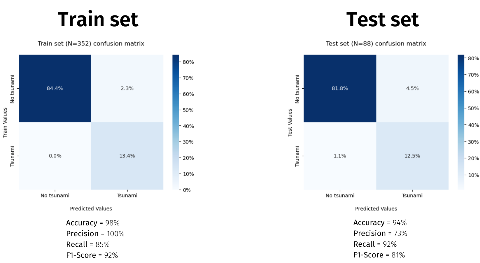
The machine learning model was fine-tuned and tested, obtaining the following performance:
 {fig-align=”center” width=”75%”}
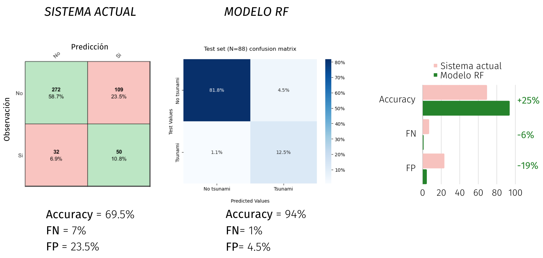
Comparison with Current System
The machine learning classifier significantly improves performance metrics over the original threshold-based method.
 {fig-align=”center” width=”70%”}
More Info
 {width=”500px” fig-align=”center”}